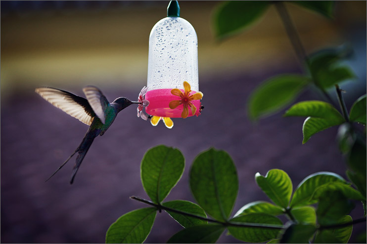
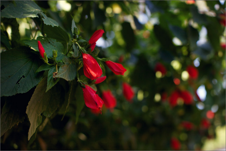
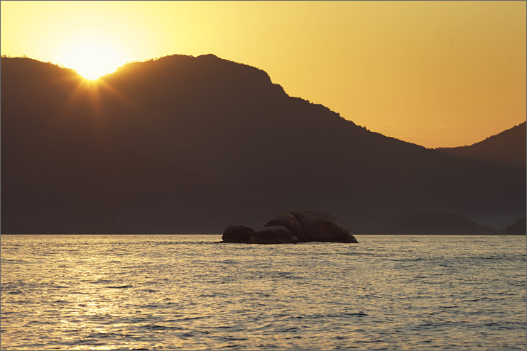
After weeks of ice, snow and glaciers, I was ready to return to the tropics. When I arrived in Rio de Janeiro to attend my cousin's wedding, I had a few extra days to escape to Ilha Grande, a tropical island off the coast of Rio. I was glad my mom came with me; she needed a break from the big city as well. Our little hostel faced a courtyard with a tiny restaurant that served delicious, home cooked meals surrounded by hummingbird feeders.

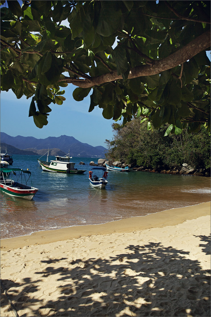
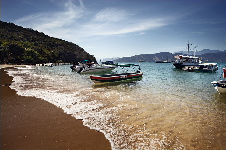
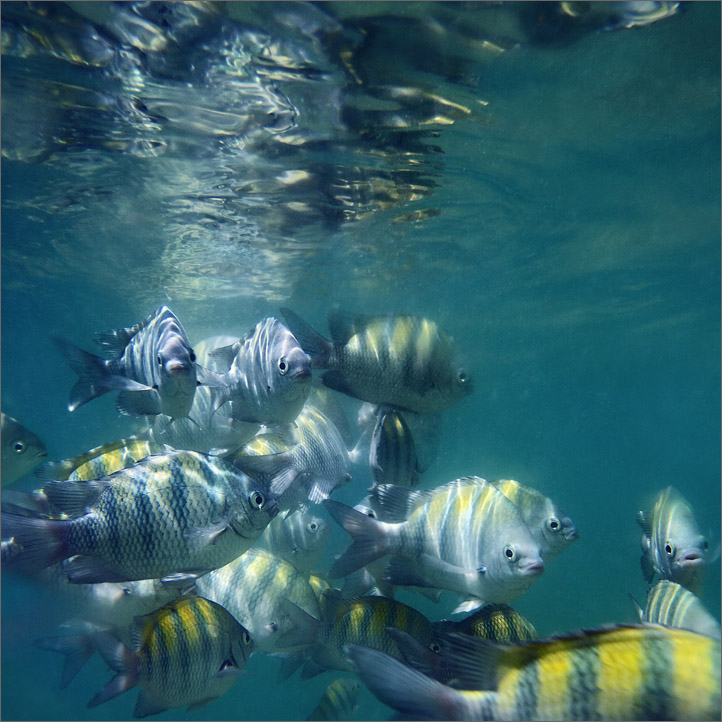
I wasn't familiar with the island, so on my first day I took a boat tour that covered many of the region's best beaches. A week of violent rainstorms left the island's crystal waters looking more cloudy than usual, so I didn't do much work underwater. The spring weather was chilly, perfect for hiking but painful for swimming. Even so, the snorkeling beaches were crowded with people. It was a little frustrating, but undeniably beautiful.


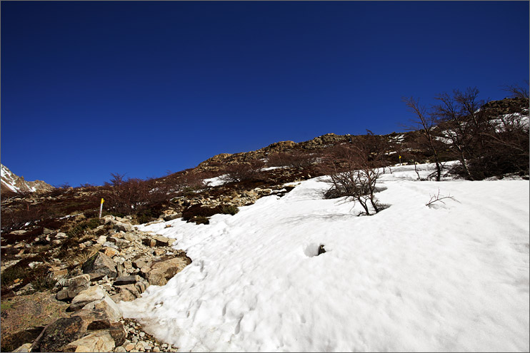
Ilha Grande is covered in all kinds of great trails that lead to a variety of hidden beaches. Determined to escape the crowds, I googled the most remote beach I could find that was within walking distance and decided on Caxadaço as my second day's destination. I knew the trail would be long, about 22 kilometers total, but after going 30 kilometers in El Chalten I felt confident that it would be fine. My mom felt good about it too, so we set out together into the forest.
Instead of using the map to get to the start of the trail, we asked locals how to get there and they directed us to a shortcut. The shortcut was an extremely rough footpath that went straight up the mountain through the jungle. I was thankful for the cool weather and couldn't imagine what it would be like to do the trail in the blistering heat of summer. Monkeys howled in the distance and there were exotic birds everywhere.
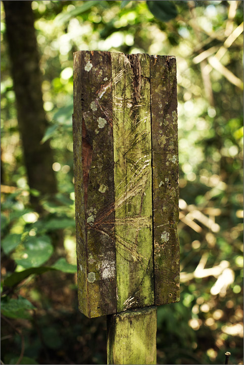
I read the the island's trails are incredibly well marked...I beg to differ. When we arrived at the end of the first shortcut, I found a sign marking its' entrance.

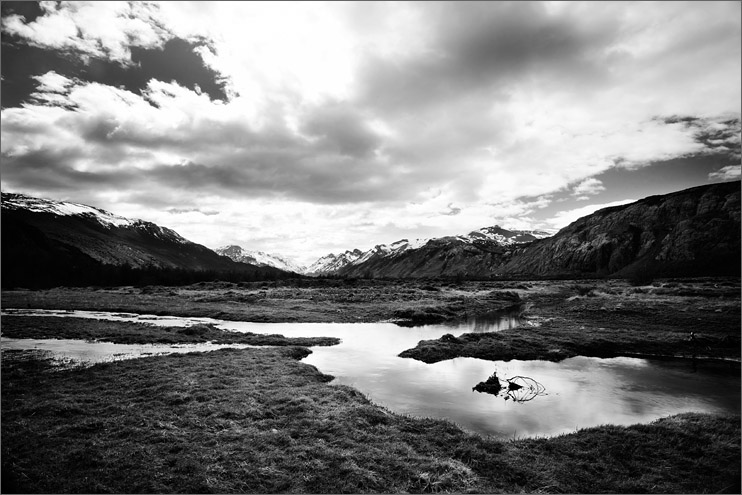
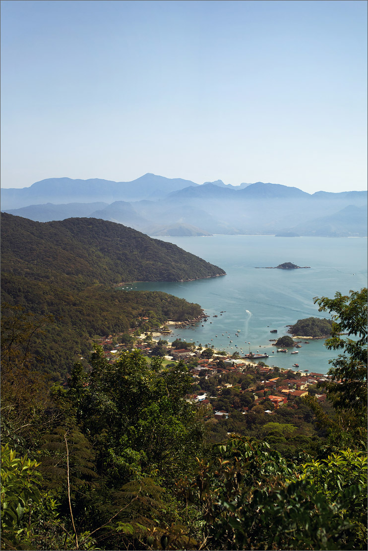
At the top of this first ridge there was a beautiful view of Abraão, the biggest city on the island. The rough trail opened up onto a large dirt road where I was surprised to see a car pass. There are no cars allowed on the island, but apparently there are exceptions to the rule.
At this point we discovered that my mom forgot to pack water. Thankfully, we passed a local on the trail to told us that the water on the island was safe to drink. It took over three hours to hike from the city to the sign indicating the trail to Caxadaço. The sign had an enormous chunk ripped out of it and other travelers had scribbled notes on the sign indicating time estimates. An hour and 40 minutes to get to the beach, sounds good. I looked at the trail ahead....It didn't look good. We decided to walk just a couple of minutes to see if it improved. It didn't. The little foot path looked fun to me, but we determined it was too risky and turned around.
We returned to the start of the trail where two guys were beginning the trail. Armed with two fit, confident young trekkers, we felt comfortable enough to turn back around and trek to the beach. They could move much faster than we could and we encouraged them to go ahead of us. It was nice to know they were on the trail and we weren't totally alone. They insisted on walking with us, saying they weren't in a hurry.
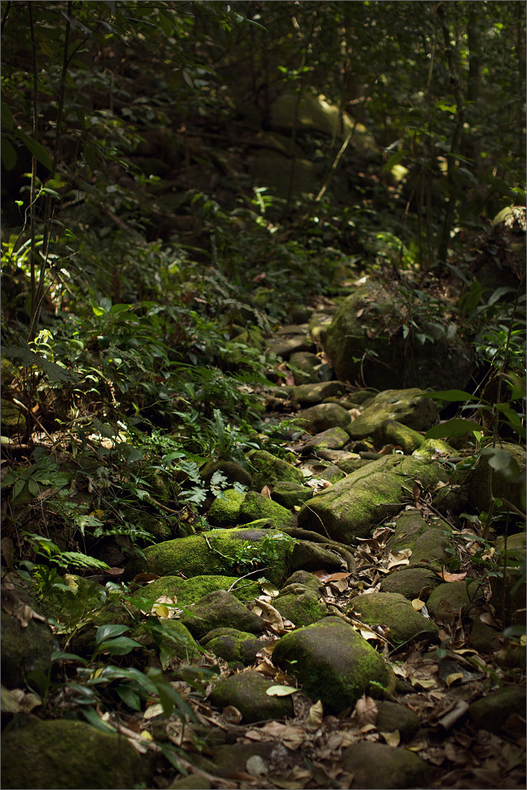
I've never felt so adventurous. Everything was so natural, no guideposts, no trash, no signs of humans except the footpath. Every 10-20 minutes I would hit a spot in the trail where I wasn't sure where to go; the path stopped and started a lot. The four of us would pause, shrug at each other, pick a route and keep going. At one point we even saw a sign!
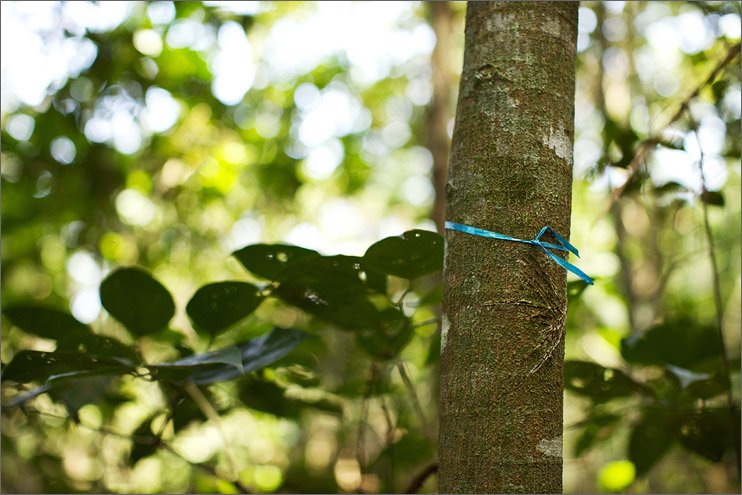
Our new friends were great, making conversation and helping the time pass more quickly. We went deeper and deeper into the woods and the trail became much less defined. We started noticing strips of blue tape and ribbon attached to trees every 40-80 feet. The trail was covered in dead trees and there were many points where we had to climb over, under or around giant limbs on the trail. We were out of breath, sweaty, and wondering when would we ever get to the beach. The guys quickly became our personal heroes, carrying my mom's backpack and sharing their water with us.
The trail got worse and worse. It wasn't so much the terrain as much as it was the lack of trail. All we had as a guide were our faithful blue ribbons. Sometimes one of us would walk ahead and look around for the next ribbon, and shout back to the group when we found it.
The trail got worse and worse. It wasn't so much the terrain as much as it was the lack of trail. All we had as a guide were our faithful blue ribbons. Sometimes one of us would walk ahead and look around for the next ribbon, and shout back to the group when we found it.

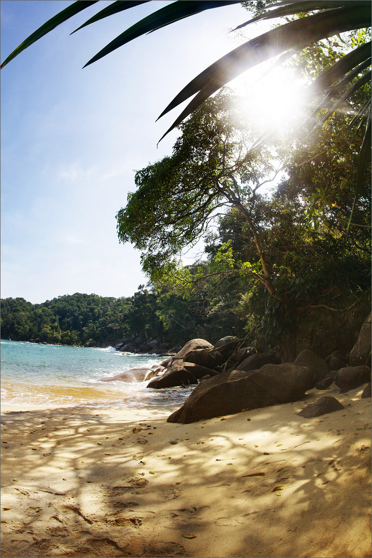
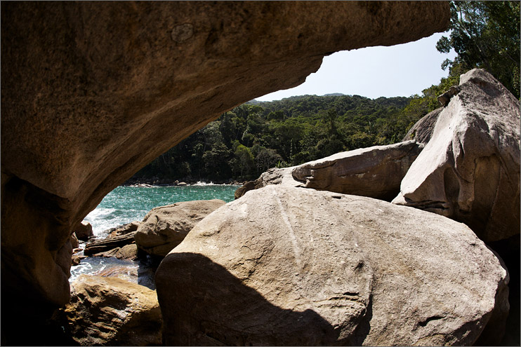
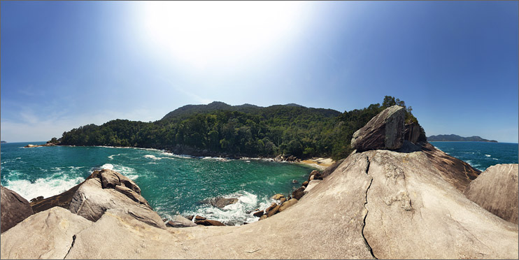
We could hear the ocean; it was so tempting. All I wanted to do was dive in and cool off, but it still seemed so far away. We had been walking together for 2 hours when we hit a marker that said "30 minutes." The trail wound around, up, down, left, right. I was so relieved to finally see the ocean. The four of us stood on the beach and took a breath. We were the only people in the entire world to see Caxadaço beach that day. How special.
It had taken us almost 5 hours to get there and we had a long walk home ahead of us. Mom and I left the guys on the beach because we were tired and needed to go slowly. We said our goodbyes but were confident they would meet us on the trail again since they move much faster than we do. They gave us an empty water bottle so we could fill it once we hit fresh water.
It was tough going, but we recognized landmarks and there were a number of blue ribbons. After we passed a huge patch of thick bamboo, the going got tricky. The trail sort of ended, and there were no blue markers. To the left looked good to me. After walking 2-3 minutes that way, the trail REALLY ended. We turned around and went back. We stood there a bit, then decided to go to the right. We walked a couple of minutes and saw a white ribbon. I didn't remember any white ribbons on our way there, but we kept going. My confidence wavered until we finally saw a blue ribbon. Thank goodness. There wasn't really a trail...but there was a marker.
I looked ahead. The forest was playing tricks on us. Everywhere I looked I could see a "trail," but for all I knew, these trails could have been made by monkeys. Mom saw a tree she recognized. I didn't remember it, but we kept moving. Soon we discovered that we were completely surrounded by so many enormous ants that we could no longer see the ground. We ran, kicking and smacking our legs, not even caring where we were. We got out of the ants and cleaned them off. It had been way too long since we last saw a blue marker. I got a sinking feeling in my stomach. I wasn't confident, there were no markers to lead the way and if we kept going I wouldn't even be able to make it back to the beach to try a new path.
Mom shouted that we needed to go "TOWARDS THE LIGHT." I tried to explain to her that "the light" was "the sky" and wouldn't help us. Monkeys were howling at us, sounding much closer than before. I refused to take one more step without some sort of trail or marker. We were miles away from the main road in a dense jungle and the sun was setting. Images of us sleeping alone in the jungle flashed in my mind and my stomach turned. I told Mom we should go back to the last blue marker while we still had a chance to find our way back. My plan was to go all the way back to the beach and find the guys. We originally set off on our own to move calmly and not burden them any more, but I refused to be lost in the forest and if buying the guys a big dinner in exchange for helping us through the forest meant not spending the night getting eaten by monkeys, that was fine with me.
We turned around and I looked into the forest. A knot formed in my throat as I realized that I might have made that decision a step too late. We wandered in the direction we came. Mom was panicking, so I knew I couldn't panic too. We had been wandering lost for way too long at this point, and we were really worried the guys had left the beach already and were passing us on the trail. We whistled and screamed, hoping they would hear is. Some of the birds were imitating us, which would have been cute if we weren't so scared.
I finally made it back to the rock I recognized and could see the tree Mom recognized in the distance. At each recognizable landmark I would run ahead of Mom 20-30 feet to check out the woods, looking for a new landmark I recognized. I called to Mom once I found one. We continued this way, always within earshot of each other and finally made progress. We found the vicious ant colony and ran for a bit. After an agonizing hour of walking, I finally found a blue marker and eventually the bamboo. I definitely knew the trail from there, so I took off my backpack and told mom to wait for me. "What if the guys aren't there?" "Then we sleep on the beach, Mom."
I ran down the mountain with our empty water bottle. We needed water and a stream that fed into the ocean was the only fresh water for about 2 miles. I ran the rest of the way, praying with every bone in my body that the guys were still there.
I burst onto the beach.
The guys were fast asleep. After the past hour of hell, I actually felt bad waking them up. "Guys?" They sat up sleepily, confused. I stood there soaked in sweat, clutching my water bottle. I didn't even know where to start. "We tried, we really tried, but we got so lost. I couldn't find the trail, we were so scared. I will buy you dinner and a new car if you help us back to the big road. I don't want to ruin your day, but I really don't want to die in the rainforest."
They were still a little lost, "Where is your mom." "She's at the top of the big hill, she's waiting because I wanted to go faster to find you guys! I'm sorry, yall can keep relaxing, we can wait, we just don't want to go alone." They insisted that they were going to head back anyway and started packing. I told them to relax and they asked me to wait for them with my mom at the top of the hill.
I gave Mom some water and sat for a while, catching my breath. It was getting late; how in the world could we make it back to Abraão before dark? We were exhausted, stressed, and Mom was still freaking out. When we met up with the guys Mom started sobbing, thanking them over and over. They offered Mom a cookie and even after all of the terror, the sight of my sweating, sobbing mother eating an oreo was really cute.
We got to the point in the trail that caused all of this mess. The guys looked around calmly, told us to wait, and darted in opposite directions into the forest. Every once in a while they called to each other in quick Spanish, discussing the success of their routes. I worried a little bit, but if they couldn't find the way then at least it would be four of us sleeping on the beach instead of two. We regrouped. Mom asked what they do when they get lost and they looked at each other, shrugged, and said "This."
They both had such calm, confident demeanors when it came to the jungle. Apparently this trail was nothing compared to the mountain they climbed in Tanzania. They decided on a route and trudged forwards. The further we went, the more blue markers we saw. I was so relieved and giddy to finally be on the trail again. The time passed really quickly. I could hear one of the guys talking to mom, asking her questions and helping her calm down. I was so incredibly grateful for the both of them. I could tell my mom to calm down and breathe for days without success. Hearing it in a British accent from a muscly trekker works much better for her. The guys shared the weight of Mom's heavy backpack and we tried to distract her from the trauma of getting lost.
After 2 hours at a steady pace, we made it back to the main road. I've never been so relieved to see dirt. We weren't 'out of the woods' yet though. Earlier in the day it had taken me and my mom over 3 hours down hill to get to this point. I really wanted to give these guys a good meal, but if we kept walking with them at their speed it will just about kill Mom. They moved so fast and we were all trying to beat the sun. Our heroes insisted on staying with us and we charged up the road.
Mom was shaking and hurting, but she was determined not to be in the dark. She hurt her shin and was bleeding, but wouldn't let me patch her up. We arrived at the mouth of a hidden shortcut and the guys said that we could cut 3/4 off the length of the walk if we took it. It was extremely steep the entire way, mom's legs were giving up on her and the guys followed behind her, calmly coaching her to take deep breaths. Mom sobbed for most of the 40 minute shortcut. Even after we finished the insane trip up the mountain, we still had to go back to Abraão. It was pitch black outside and we still had an hour and a half of walking left to reach our hotel.
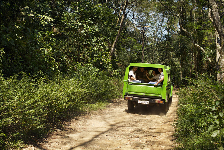
Then we heard the most magical sound of all, an engine. That truck I saw at the beginning of the day was coming up the road, and Mom turned with a look of fierce determination. The truck looked like it was going to pass us, but Mom was waving like crazy and it slowed to a stop. She ran to the open window shouting in English, forgetting she was in Brazil. When the driver couldn't understand her, she switched to broken Spanish, which didn't work either. Finally, we were able to get some Portuguese out of her (Portuguese is her native language). We all piled in and the driver started down the road. We told him our story and laughed and cried all the way down the mountain. We took the guys out for dinner and thanked them over and over.
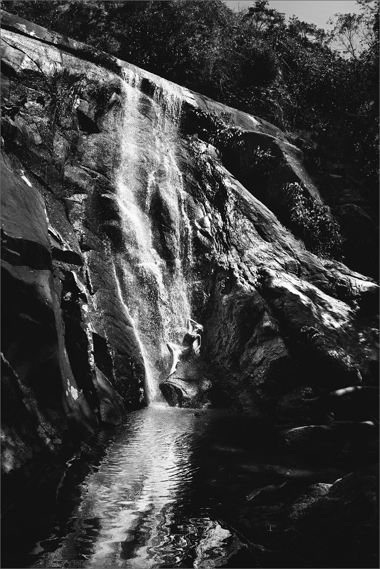
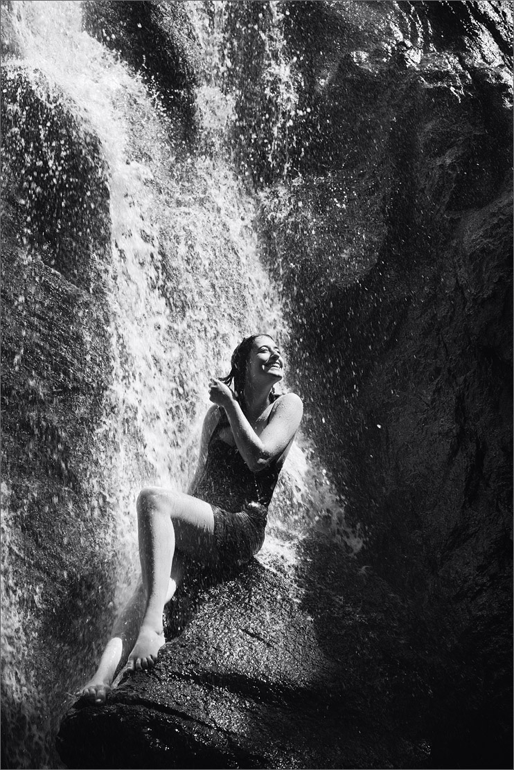
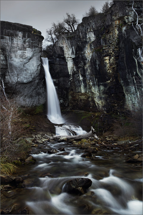
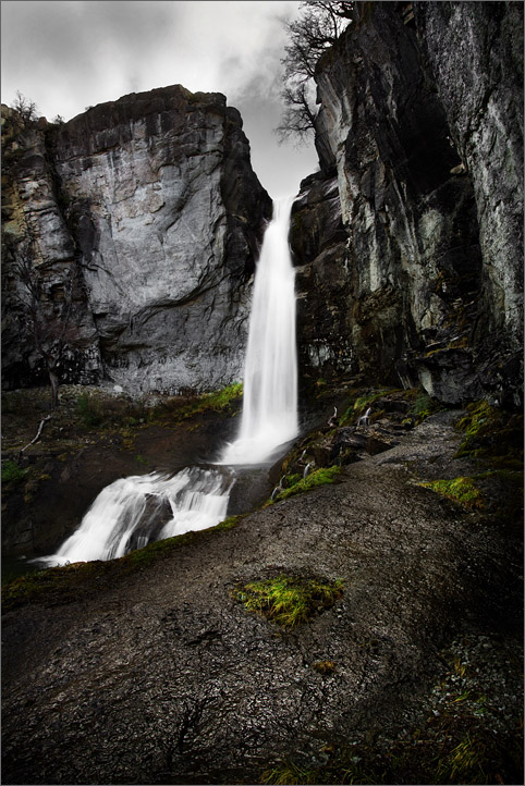
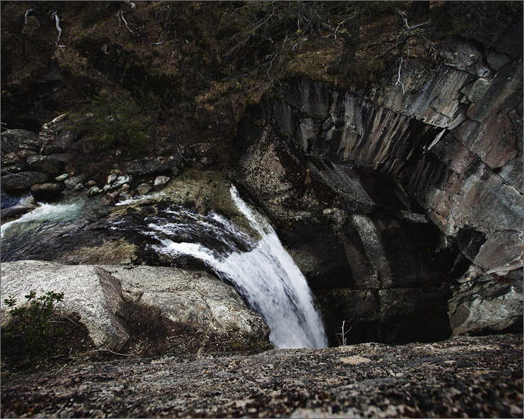
The next day was our last day on the island and we didn't want to spend it traumatized in bed. Instead, we took an hour and a half long trail to a waterfall where I had the opportunity to shoot some self portraits. We arrived just as everyone left the waterfall to go get lunch, so there wasn't a soul in sight. I braved the freezing water for portraits.